By Fatin Syazana, Malaysia Country Manager, Airscan
When Kuala Lumpur’s city hall became a direct partner in the SETARA Environmental Monitoring initiative, the decision carried more weight than a standard technology adoption. DBKL was committing to something that most local authorities in Malaysia have talked about in policy documents and planning workshops for years: governing with real-time environmental data, at city scale, continuously, with the results visible to the public.
SETARA is a collaboration between EDOTCO Group and Airscan, with DBKL, Kuala Lumpur’s city hall, as a direct stakeholder. The initiative places a network of outdoor air quality monitors across KL’s city centre, mounted on EDOTCO’s existing telecommunications towers. The sensors measure PM1, PM2.5, PM10, SO2, CO, O3 and NO2 continuously, with meteorological data layered in to separate weather-driven pollution patterns from source-driven ones, a distinction that matters enormously when you’re trying to attribute a spike to fireworks, construction dust, or traffic congestion rather than to a passing weather front.
What makes DBKL’s involvement worth examining closely is how it demonstrates five governance principles that other Malaysian municipalities can replicate directly, using infrastructure most of them already have.
Existing infrastructure, repurposed
Malaysia has had national air quality monitoring stations for years. It lacked localised, continuous data, the kind that reveals conditions at street level, near a school gate, beside a construction site, or downwind of an industrial zone.
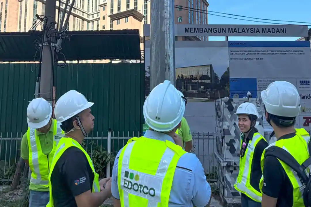
DBKL addressed this gap by embedding sensors into EDOTCO’s tower network, which already had power, connectivity, and physical mounting points distributed across the city. The sensing layer was the missing piece, and adding it required no new civil works or standalone monitoring stations. For municipalities working within tight capital budgets, this is the detail that matters most: the most expensive part of the system already exists.

A measured baseline that makes planning accountable
Before SETARA, decisions about Low Emission Zones, pedestrianisation schemes, and traffic restrictions in KL relied on modelling and assumption. Planners could estimate pollution impacts without any way to measure them directly.
With the sensor network active, DBKL has before-and-after measurement capability at a resolution no local authority in Malaysia has previously held. When a planning intervention goes in (e.g. a road closure, a green corridor, a vehicle access restriction), the network shows whether pollutant concentrations actually changed, where, by how much, and under what weather conditions. That accountability loop is what turns urban planning from estimation into evidence, and it’s the kind of capability that compounds in value over time as the baseline dataset grows.
Real-time responsiveness
One of the earliest demonstrations of the network’s sensitivity came during Hari Raya celebrations, when PM2.5 spiked sharply across all sensors just after midnight for three consecutive nights. This is the direct signature of fireworks, visible and attributable in the data within hours.
The system gives city officials the ability to detect, locate, and attribute a pollution event that manual sampling and periodic lab analysis cannot match, while an event is still happening. The applications extend well beyond festivals. Industrial incidents, construction dust events, and haze episodes all demand the same speed, and in each case, timing determines whether a public health advisory reaches people when it can still change behaviour.
A partnership structure that distributes cost and capability
SETARA works because each partner contributes what it does best. EDOTCO provides the tower infrastructure and connectivity. Airscan provides the environmental sensing, hardware and data layer that turn raw measurements into action. DBKL provides governance authority and planning application.
The resulting system is more capable and more cost-efficient than any single organisation could build alone, and the structure is directly transferable. Any municipality with access to a telecoms tower footprint, which in Malaysia means virtually every urban area, can replicate this model.
One deployment, multiple SDG targets
Urban sustainability initiatives typically require separate infrastructure investments for each objective: one system for transport monitoring, another for environmental sensing, another for public health surveillance, another for planning evaluation. Each carries its own procurement cycle, capital cost, and maintenance overhead, and each competes for the same limited municipal budget.
SETARA operates differently. A single sensor network, mounted on shared infrastructure, advances progress across multiple UN Sustainable Development Goals (SDG) simultaneously, without requiring each goal to justify its own dedicated investment. That efficiency is what makes the model replicable for municipalities that cannot afford to pursue development targets one infrastructure project at a time.
The strongest alignment is with SDG 11, Sustainable Cities and Communities. The network provides exactly the kind of environmental intelligence that SDG 11 calls for: the ability to measure whether urban planning interventions actually change outcomes, with data specific enough to show where improvements are landing and where they are not. Low Emission Zones, traffic restrictions, and green corridor projects can all be evaluated against measured air quality data rather than projected models.
The second major alignment is with SDG 3, Good Health and Well-Being. Continuous monitoring of PM1, PM2.5, PM10, SO2, CO, O3 and NO2 near schools, hospitals, and residential areas enables targeted public health responses based on actual exposure data. High-exposure zones can be identified and addressed before health outcomes deteriorate, a different approach entirely from studying the damage retrospectively through hospital admission statistics. Or rather, it a enhances the traditional approach with a more holistic view of sources and events leading to its eventual effects.
A visual summary of all SDG and MySCF alignments accompanies this article below:
| SDG | SETARA alignment |
|---|---|
| SDG 3 Good Health and Well-Being |
SETARA provides continuous, localised monitoring of PM2.5, PM10, and NO2 — the pollutants most directly linked to respiratory illness, cardiovascular disease, and premature mortality. By identifying high-exposure areas near schools and hospitals, it enables targeted public health interventions and improves population health outcomes. |
| SDG 9 Industry, Innovation and Infrastructure |
The initiative repurposes existing telecoms infrastructure for environmental sensing — a direct example of resilient, innovative infrastructure development. It demonstrates how smart integration of existing assets can deliver new public value without duplicating investment. |
| SDG 10 Reduced Inequalities |
Localised air quality monitoring exposes disparities in environmental exposure across different communities. Identifying that industrial zones near residential and school areas carry higher pollution loads is the first step toward addressing environmental inequity — a dimension that national-level averages systematically obscure. |
| SDG 11 Sustainable Cities and Communities |
This is the most direct alignment. SETARA supports safe, resilient, and sustainable urban development by providing the environmental intelligence needed for sound planning decisions. The ability to measure the impact of Low Emission Zones, traffic interventions, and land use changes before and after implementation is foundational to building cities that work for people. |
| SDG 13 Climate Action |
Continuous measurement of NO2 and particulate matter contributes to Malaysia’s capacity to monitor urban emissions trends, evaluate the effectiveness of emissions-reduction policies, and build the evidence base for climate-related urban planning decisions. Real-time data at city scale is an essential component of any credible climate action strategy. |
| SDG 17 Partnerships for the Goals |
The SETARA model is inherently a multi-stakeholder partnership — telecoms infrastructure, environmental expertise, regulatory oversight, and city governance working together. This public-private-academic collaboration structure is precisely the kind of implementation mechanism the SDGs call for. |
Delivering on Malaysia’s Smart City Framework through shared infrastructure
The same single-infrastructure logic applies to Malaysia’s Smart City Framework. Developed by the Ministry of Housing and Local Government in 2018, MySCF sets out the national blueprint for smart city development, and SETARA’s KL deployment activates several of its components through one integrated system rather than through separate, siloed investments.
The primary alignment is with the Smart Environment component, which explicitly calls for improved air quality monitoring, advanced environmental technology, and cloud-based monitoring systems. SETARA delivers on most of these through continuous sensor measurement, and meteorological analysis that gives context to every reading.
The KL city centre deployment directly supports Smart Mobility evaluation by giving planners measured data on whether traffic interventions and vehicle access restrictions actually affect air quality, evidence that transport policy decisions have historically lacked at the local level.
MySCF identifies air pollution, loss of green area, and high urban carbon footprints as critical challenges requiring technology-enabled responses. What SETARA demonstrates is that the response can be built from what already exists, governed through partnership, and extended through replication rather than reinvention.
What comes next
EDOTCO operates over 47,000 towers across Asia. The sensing layer that makes this monitoring possible is designed to be added to any tower with power and connectivity, which, in practice, means most urban telecommunications infrastructure in Malaysia. Cities like Johor Bahru, Penang, Kuching, and Kota Kinabalu, all of which face their own traffic, industrial, and air quality pressures, have the same tower footprint available to them.
The SETARA deployment in KL has moved past proof of concept. The model works, the data is flowing, and DBKL’s early results, from the Hari Raya fireworks detection to the baseline establishment for planning evaluation, show what becomes possible when a city authority commits to evidence-based environmental governance.
For a closer look at how SETARA works in practice, see the full project case study. If you’re a city authority, municipal planner, or infrastructure operator exploring environmental monitoring for your area, visit Airscan’s Outdoor Air Quality Monitoring page.